42 Types of Map Symbols
In a map, the objects are shown by symbols or signs, not by names. Following are the 42 types of map symbols that are used for civil engineering surveying and levelling.
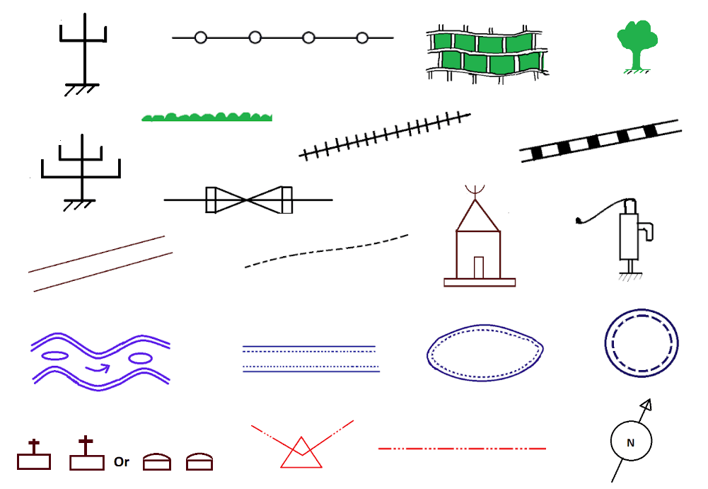
And, what colour is used for different objects such as river, railway, road bridge, culvert, tube well, open well, level crossings, temple, huts, church, tree, jungle, building, hedge, cultivated land, telegraph line, etc are also given below.
1. North Line Symbol
For the north line, the symbol is like that
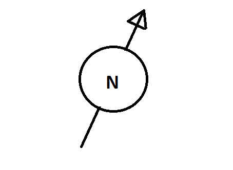
North line symbol colour is Black.
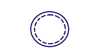
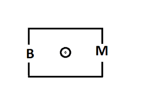
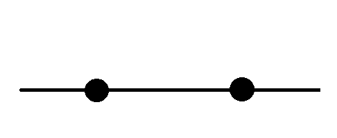
2. Main Station or Triangulation Station Symbol
Main station or triangulation station symbol is like that
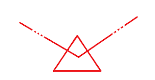
Main Station Symbol colour is Red or crimson lake.
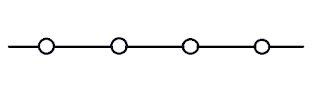
3. Traverse Stations or Substations Symbol
The symbol of traverse stations or substations is as follows

Traverse stations or substation symbol colour is Red or crimson lake.
4. Chain Line Symbol
The chain line Symbol is
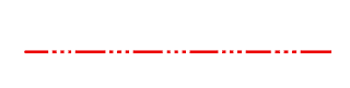
The chain line symbol colour is Red or crimson lake.
5. River Symbol
River symbol on the map
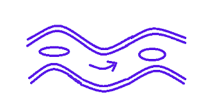
The river symbol colour is Prussian blue.
6. Canal Symbol
The symbol for the canal
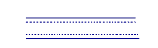
The canal symbol colour is Prussian blue.
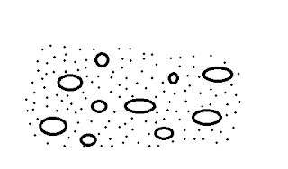
7. Lake or Pond Symbol
The symbol for the Lake or pond
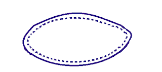
Lake or pond symbol colour in a map is Prussian blue.
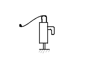
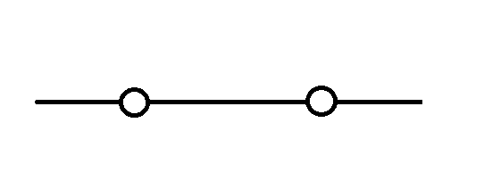
8. Open Well Symbol
For open well, the symbol is like that
Open well symbol colour is Prussian blue.
9. Tube Well Symbol
Tube well symbol is
The tube well symbol colour in a map is Black.
Read Also: Failure of Tube Well.
10. Footpath Symbol
Symbol of the footpath is like that
Footpath symbol colour is Black.
11. Metalled Road Symbol
Metalled road symbol is as below:
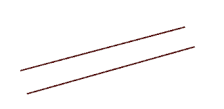
Metalled road symbol colour is Burnt sienna.
12. Unmetalled Road Symbol
The symbol for the Unmetalled road
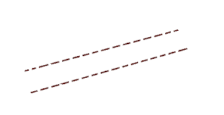
Unmetalled road symbol colour is Burnt sienna.
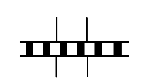
13. Railway Line(Single) Symbol
For the railway line(single), the symbol is like that-
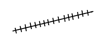
Railway line(single) symbol colour is Black.
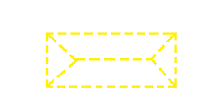
14. Railway Line(Double) Symbol
The symbol for the Railway Line(double)
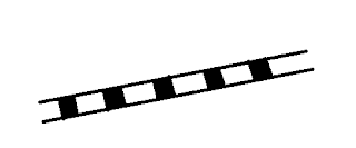
Railway Line(double) symbol colour is Black.
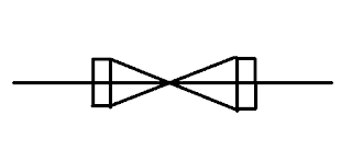
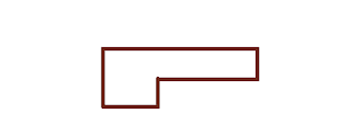
15. Road Bridge or Culvert Symbol
Symbol of the road bridge or culvert
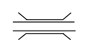
Road bridge or culvert symbol colour is Black.
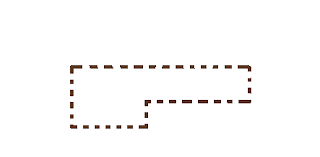
16. Railway Bridge or culvert
Railway bridge or culvert symbol
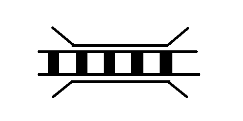
Railway bridge or culvert symbol colour is Black.
17. Level Crossing Symbol
Symbol of level crossing
The colour of the level crossing symbol is Black and burnt sienna.
18. Wall with Gate
The symbol of the wall with the gate is-
Wall with gate symbol colour is Black.
19. Boundary Line Symbol
The symbol for the Boundary line
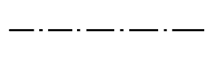
The colour of the boundary line symbol is Black.
20. Hedge Symbol
The symbol for a hedge is like that

Hedge symbol colour is Green.
21. Wire Fencing Symbol
Wire fencing symbol –
Wire fencing symbol colour is Black.
22. Pipe Fencing
The pipe fencing symbol is
Pipe fencing symbol colour is Prussian blue.
23. Wood Fencing
Wood fencing symbol

Wood fencing symbol colour is Yellow.
24. Building(Pukka) Symbol
The symbol for the Buildings(pukka) is like that
The colour of the building(pukka) symbol is Crimson Lake.
25. Building(Katcha) Symbol
The symbol used for building(Katcha) in a map is like that
The symbol colour of the building(Katcha) is Umber.
26. Huts Symbol
The symbol used for huts is given below.
Huts symbol colour is Yellow.
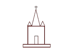
27. Temple Symbol
The Temple symbol used in a map is like that
The Temple symbol colour is Crimson Lake.
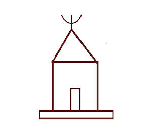
28. Church Symbol
Church symbol used in a map is as below.
The church symbol colour is Crimson Lake.
29. Mosque Symbol
The mosque symbol is like that
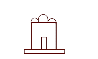
The mosque’s symbol colour is Crimson Lake.
30. Benchmark Symbol
The symbol used for benchmark in a map is
Benchmark symbol colour is Black.
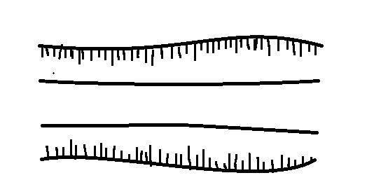
31. Tree Symbol
The symbol of the tree on a map is
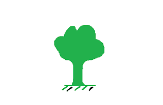
The colour of the tree symbol is Green.
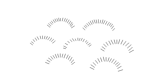
32. Jungle Symbol
Symbol of the jungle
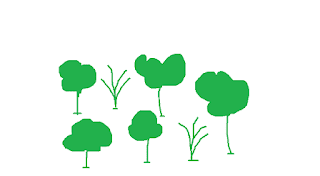
The colour of the jungle symbol is Green.
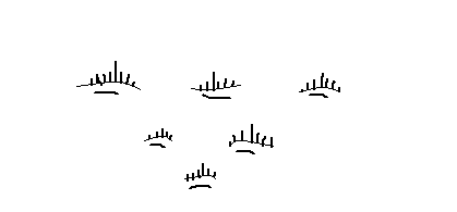
33. Orchard Symbol
Symbol of the orchard
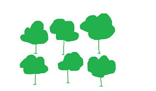
Orchard symbol colour is Green.
34. Cultivated land symbol
Symbol of the cultivated land
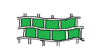
The symbol colour of the cultivated land is Black & Green.
35. Barren land symbol
The symbol for the barren land
Barren land symbol colour is Black.
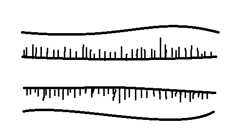
36. Rough pasture Symbol
Symbol for the rough pasture
Rough paster symbol colour is Black.
37. Marsh or Swamp Symbol
The symbol used for marsh or swamp in a map is as below.
Marsh or swamp symbol colour is Black.
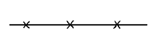
38. Embankment Symbol
Embankment symbol
Embankment symbol colour is Black.
39. Cutting Symbol
The cutting symbol is
The cutting symbol colour is Black.
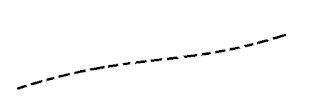
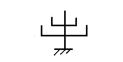
40. Telegraph Line & post Symbol
The symbol used for the telegraph line in a map is like that
The symbol used for the telegraph post
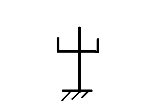
The telegraph line & post symbol colour is Black.
41. Electric line & post Symbol
The symbol for the electric line
The symbol used for the electric post is as follows
The electric line & post symbol colour is Black.
42. Burial ground or Cemetery Symbol
The symbol used to indicate burial ground or cemetery is as below.
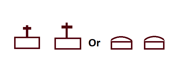
The burial ground or cemetery symbol colour is Crimson Lake.
Read Also: