Skip to content

CivilNotePpt

  • Home
  • CONCRETE
  • Highway
  • Railway
  • WasteWater
  • BMC
    • Building Construction
    • Building Material
  • soil

Preliminary Survey || Method || Important Point-Highway Engineering

Posted on 15th March 201922nd February 2022 By Malay Sautya

The survey of highway can be completed in four Stage(map study, reconnaissance survey, preliminary survey, final location and detailed survey), the third stage is known as the Preliminary Survey.

Contents

  • 1 Preliminary Survey
    • 1.1 Method Of Preliminary Survey
      • 1.1.1 1. Conventional Method
      • 1.1.2 2. Modern Approach
    • 1.2 Important Point to be Followed during Preliminary Survey

Preliminary Survey

The art of finding the details of alternative alignments found suitable during the reconnaissance survey is called preliminary survey.

Preliminary Survey || Method || Important Point-Highway Engineering

In this survey, the routes selected during the reconnaissance survey, are actually located on the ground. The highway engineer collects necessary data in the field and prepares drawings and approximate estimates to compare the alternative routes and to finalize the best alignment from all consideration. 

Method Of Preliminary Survey

The preliminary survey is carried out by anyone of the following methods.

1. Conventional Method

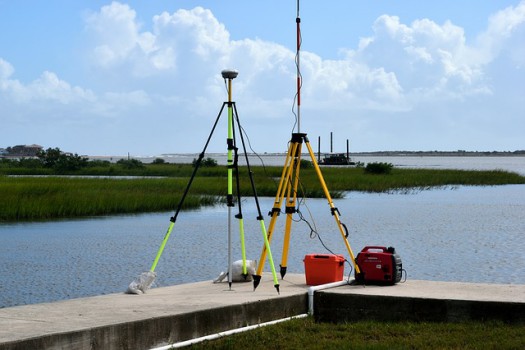
In the conventional method, a survey party carries out surveys by using the field equipment like a chain, metallic tape, prismatic compass, levelling instrument, plane table, theodolite etc.

The survey party takes measurements, collects topographical and other data and also conduct soil survey. 

2. Modern Approach

In this method, necessary topographic and other maps including details of soil and geographical features of the area are obtained by Arial survey.

Important Point to be Followed during Preliminary Survey

1. The angle of traverse should be very accurately measured by theodolite.

2. The length of the centre line should be measured by using very good and accurate chaining method or by techometry or by modern instruments.

3. Cross-section levels should be taken at suitable intervals.

4. Drainage investigations and hydrological data are to be collected carefully so as to estimate the type, number and approximate size of cross drainage structures.

5. Soil survey is to be carried out very carefully.

Read also:

Reconnaissance Survey

Final Location And Detailed Survey 

Highway engineering

Post navigation

Previous Post: 4 Steps in Bituminous Road Construction
Next Post: 3 Objects of Highway Survey

Related Posts

  • 5 Methods of Soil Stabilization – Mechanical, Chemical, Cement, lime Highway engineering
  • Comparison & Difference Between Asphalt, Bitumen and Tar
    Comparison & Difference Between Asphalt, Bitumen and Tar Highway engineering
  • Borrow Pits
    Borrow Pits Highway engineering
  • 4 Types Of Camber Highway engineering
  • Transition Curve In Highway-Objects || Types || Essential Requirement Highway engineering
  • Objects of Road Side Development and Arboriculture Highway engineering
  • Causes of Planting of Tree on Road Sides and Method of Care of Trees-Highway Engineering Highway engineering
  • Lead and Lift in Earthwork Highway engineering
  • The Bombay Road Plan || Highway Engineering Highway engineering
  • Purposes/Objects Of Providing Camber Highway engineering

Categories

  • Highway engineering
  • Railway Engineering
  • BMC
  • WasteWater
  • soil
  • CONCRETE
  • Building Construction
  • Irrigation Engineering
  • Hydraulic Structure
  • water
  • Cement
  • Foundation Engineering
  • Aggregate
  • Mathematical Example
  • Tunnels
  • Survey Engineering
  • PAVEMENT DESIGN
  • Hydrology
  • PAVEMENT DESIGN – MCQ
  • Building Material
  • Floors
  • Highway Engineering – MCQ
  • HYDROLOGY M.C.Q
  • Engineering Geology – M.C.Q
  • Railway Engineering – MCQ
  • Water Supply – MCQ
  • Building Materials – MCQ
  • Soil Engineering – MCQ
  • Irrigation Engineering – MCQ

Popular Posts

  • 40+ Best Online Furniture Stores – Choose Your Best Option!
  • 10 Types of Roads Classification in India(Urban & Non-Urban Road)
  • 3 Characteristics of Sewage – Physical, Chemical and Biological Characteristics
  • TYPES OF RAILS – Double Headed, Bull Headed and Flat Footed Rails
  • 6 Types of Classification of Gradient – Ruling, Limiting, Exceptional, Minimum, Average and Floating Gradient
  • Railway Gauge – || Definition || Types || Factor Affecting || Advantages of Uniform Gauge ||
  • 8 Different Types of Cement Test || Building Materials & Construction
  • History of Road Development in India
  • 100+ All Traffic Signs or Road Safety Signs in India as per IRC
  • Stone - MCQ || Building Materials ||
    Stone – MCQ || Building Materials || Building Materials - MCQ
  • Depth Of Soil Exploration For Different Footings Foundation as per IS:1892 Foundation Engineering
  • Factors Governing The Length of Rail Railway Engineering
  • Grade Compensation on Curves of Railway Track Railway Engineering
  • Choice of The Separate Sewer System WasteWater
  • Combined Gravity And Pumping System WasteWater
  • Pit Privy WasteWater
  • What is the Coefficient of Consolidation, Compressibility and Volume change With Their Equation consolidation

Primary Menu

  • Home
  • About us
  • Contact

Top Posts & Pages

  • 12 Basic Principles of Building Planning
  • World's Top 10 Countries Having Largest Railway Network 2022
  • 100+ All Traffic Signs or Road Safety Signs in India as per IRC
  • 19 Types Of Sewer According To Material And Place of Use
  • Advantages and Disadvantages of Traffic Signals

Copyright © 2022 CivilNotePpt.

Powered by PressBook News WordPress theme